Global Early Warning System for Wildland Fire
Mapping Products
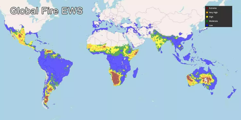
Global Fire EWS 10-day forecasts

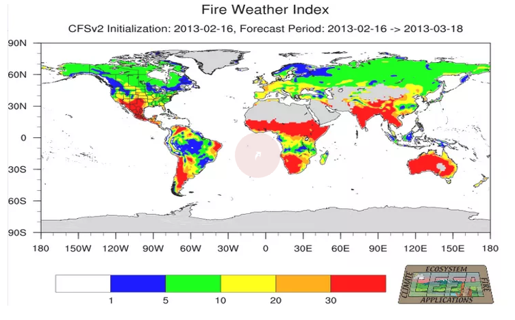
Global FWI Monthly Forecasts
 Outline of Fire Danger Products in the Global Fire EWS
The fire danger indicators currently presented on the Global Fire Early Warning System (Global Fire EWS) are components of the Canadian Forest Fire Weather Index (FWI) System. The Global EWS provides 1-10 day forecasted FWI System data based on the Canadian Meterolological Centre’s (CMC) Global Deterministic Forecast System (GDPS). The FWI System components are currently calibrated to commonly used threshold values that identify low to extreme conditions. As such, the Global EWS provides a means of comparing relative fire danger conditions between countries, continents, and biomes; and the 1-10 day forecast identifies the expected future fire danger trend. This type of information is often useful for large-scale fire management decision-making such as planning cross-border suppression resource exchanges.
Although these indicators can be used to compare fire danger across the globe, the indicators are not calibrated to the local fire regime, which includes the influences of fuel, ignition sources, climate, fire management/suppression policy, etc. For that reason, the next stage in development of this system is regional calibration to adjust the fire danger scales using historical fire data (primarily remotely sensed) and weather data. This will calibrate the fire danger indicators to provide operational-level information such as potential for fire starts and difficulty of control. Regional calibration will be an on-going collaborative effort with regional and national agencies.
The FWI System has 6 components that represent fuel dryness and potential fire behaviour at the landscape level. All components are presented in the Global EWS:
- Fire Weather Index (FWI) is a general indicator of fire danger and fire intensity
- Buildup Index (BUI) indicates dryness of medium and large dead fuels
- Initial Spread Index (ISI) is an indicator of rate of fire spread
- Drought Code (DC) indicates dryness of deep, compact organic layers in the forest floor
- Duff Moisture Code (DMC) indicates dryness of loosely compacted, upper organic layers of the forest floor; often used as a predictor of lightning-caused fires
- Fine Fuel Moisture Code (FFMC) is an indicator of the dryness of dead fine fuels; often used as a predictor of human- and lightning-caused fires
More details on the FWI System can be found on the Canadian Wildland Fire Information System website , and the Canadian Meterolological Centre’s (CMC) Global Deterministic Forecast System (GDPS) at https://weather.gc.ca/grib/index_e.html . As the Global EWS develops in future, other fire danger indicators and weather forecast models will be included for multiple comparisons. As well, various remote sensing data will be incorporated to provide additional fire danger products.

