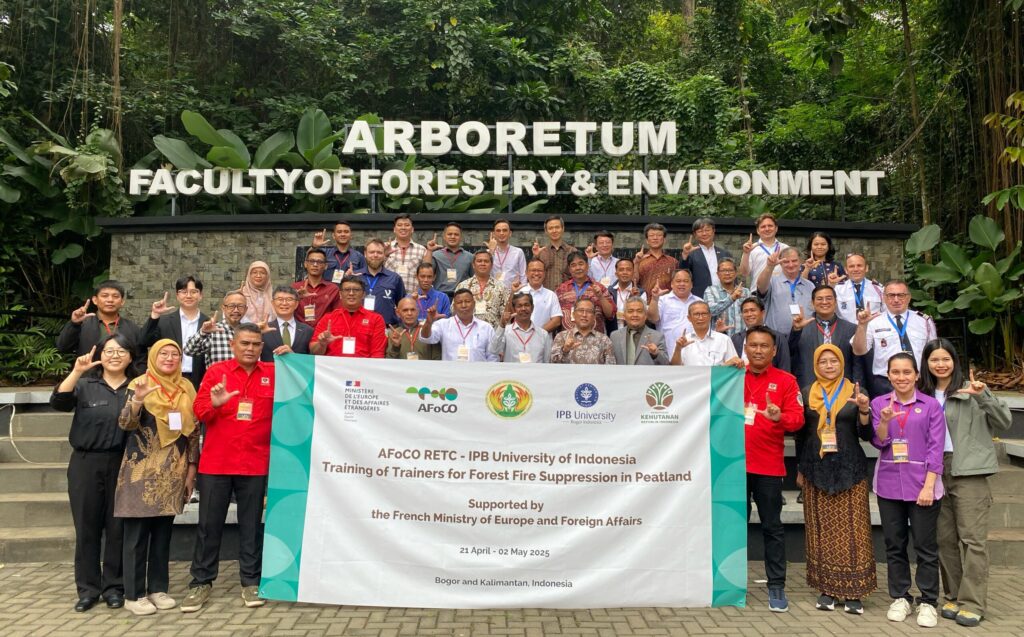
Ketapang, West Kalimantan – Fighting fires on peatlands is not something you can learn from a PowerPoint slide. In Ketapang, one of Indonesia’s most fire-prone peatland regions, 19 participants from the Philippines, Malaysia, Timor Leste, and Indonesia got their hands dirty—literally—in an international training on peat fire suppression facilitated by IPB University’s Faculty of Forestry and Environment and the Regional Fire Management Resource Center–Southeast Asia (RFMRC-SEA).
The training was not just theoretical. For one full week at IPB University, participants were guided by three fire experts from France and introduced to advanced fire suppression strategies, including the use of a fire simulator—a tool that mimics real fire behavior to prepare participants for field conditions.
Then came the real test. In Ketapang, the trainees operated out of Manggala Agni’s Regional Fire Operation Base (Daops IX Ketapang), supported by four fire crews (15 personnel), complete equipment, and field facilities.
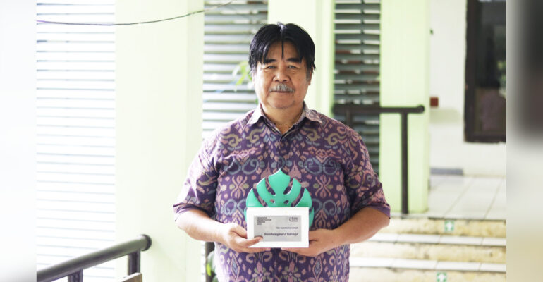
“We want them to be ready not just on paper. Understanding fire behavior on peatlands requires real field experience,” emphasized Prof. Dr. Bambang Hero Saharjo, M.Agr., a forensic expert on forest and land fires and professor at IPB University.
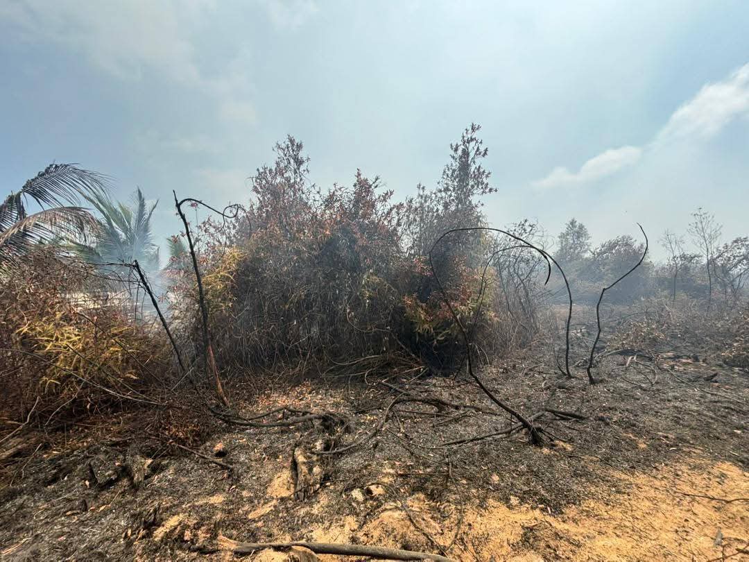
Peatland fires are notoriously difficult to suppress. Unlike surface fires, they smolder beneath the ground and can reignite even after appearing extinguished. That’s why this kind of hands-on training is so crucial.
Before facing actual fire, participants underwent a dry simulation to familiarize themselves with the equipment. “This is essential so that when they face real fire, there’s no hesitation,” Prof. Bambang added.
The real-world fire suppression took place in a controlled peatland site not far from the road, with accessible water sources. Special plots were prepared with different fuel loads and types to simulate varying fire conditions. Parameters like flame length, fire spread rate, wind direction, and local weather were closely monitored.
“We created predefined plots and measured everything—from fuel thickness and volume to air temperature, relative humidity, and wind speed—so participants could observe how fires behave under specific conditions,” Prof. Bambang explained.
The team also used thermal drones to record fire temperatures and movement patterns, providing valuable data for future training and fire management efforts.
“We’re not just putting out fires—we’re building future fire leaders who understand the science behind the flames,” he said.
Prof. Bambang confirmed that similar trainings will be held annually for the next four years in different peatland regions across Indonesia.
Other IPB University experts, Prof. Lailan Syaufina and Dr. Ati Dwi Nurhayati, also played key roles in delivering materials on peat fire ecology and impacts, as well as suppression strategies.
Why It Matters
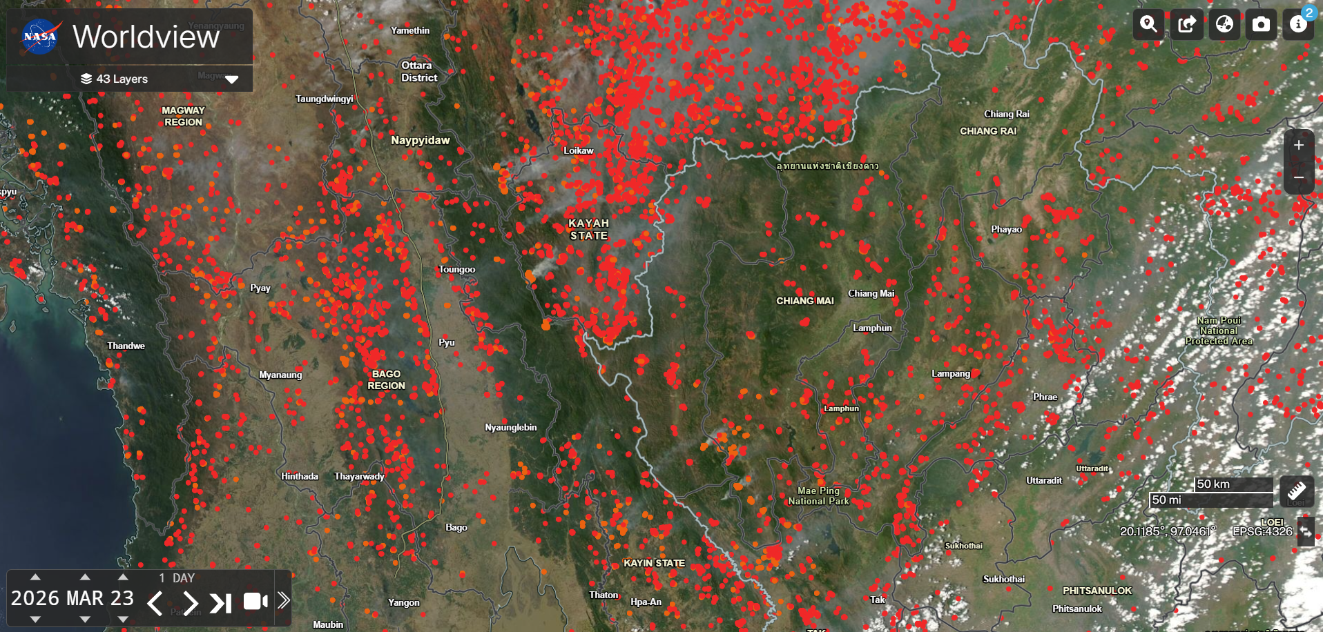
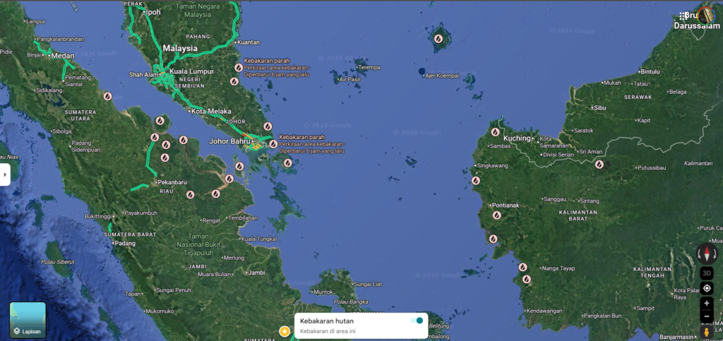
Peatland fires are not just Indonesia’s problem. Their transboundary haze affects the entire Southeast Asian region, with serious consequences for human health, biodiversity, and economies.
Prof. Bambang, who is also a leading figure in international fire science forums, has long advocated for data-driven and science-based fire management. In one of his published articles, he emphasized:
“Peat fires are not merely technical problems but ecological disasters that require integrated solutions based on science and collaboration.”
— Bambang Hero Saharjo, in “Combating Peatland Fires in Indonesia”, Environmental Science Journal, 2020.
Selected References by Prof. Bambang Hero Saharjo:
-
Saharjo, B.H. (2020). Combating Peatland Fires in Indonesia: Between Policy, Law Enforcement, and Scientific Evidence. Environmental Science Journal.
-
Saharjo, B.H., & Usup, A. (2017). The Use of Fire by Farmers in Peatland Areas and Its Impacts. Bogor: IPB Press.
-
Saharjo, B.H., et al. (2022). Fire Behavior and Suppression Techniques in Tropical Peatlands. Proceedings of the Regional Fire Management Forum.