15 November 2022
From the green campus of Dramaga in Bogor, Indonesia, two distinguished professors of IPB University are now sharing their expertise thousands of miles away—in Montpellier, France. Professors Bambang Hero Saharjo and Lailan Syaufina, both from the Faculty of Forestry and Environment (Fahutan) at IPB University, were officially invited to teach at the University of Montpellier as part of a special international program on Forest and Land Fire Management.
The professors will be in France until December 10, 2022, bringing with them decades of academic experience and field knowledge on one of the world’s most pressing environmental challenges: wildfires.
Indonesian Academics on the Global Stage
This is not just an ordinary teaching assignment—it is part of a high-level collaboration involving top institutions such as the University of Brasília (Brazil), University of Lleida (Spain), University of Aveiro (Portugal), and PSL University (France), coordinated by Paris Sciences & Letters (PSL) and supported by Campus France.
“Two master’s students from IPB’s Tropical Silviculture program were selected to continue their studies for a full year in Montpellier. They are expected to earn dual master’s degrees from both IPB University and the University of Montpellier,” explained Prof Bambang.
As part of the program, students attend lectures, practical sessions, examinations, and study visits to research and training centers relevant to their coursework—just like in Indonesia, but in a different climate and context.
Tropical Insights in a Four-Season Setting
As guest lecturers, Professors Bambang and Lailan were invited by PSL University to deliver courses between November 6 and December 10, 2022. Their teaching focuses on forest and land fire prevention and control—an issue they’ve studied extensively in tropical settings like Indonesia.
“In France, fires can be caused by natural factors like lightning,” said Prof Bambang. “But in Indonesia, 99.9% of wildfires are human-induced.” This stark contrast forms the basis of meaningful discussions during the course, enriching students’ understanding of fire dynamics in different ecosystems.
He also pointed out that while wildfires in France may not attract much global attention, peatland fires in Indonesia are of major concern due to their massive greenhouse gas emissions and the challenges in extinguishing them.
A Long-Term Partnership for Fire Prevention
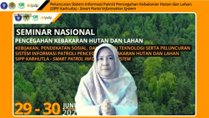
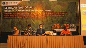
This program is part of a broader collaboration between IPB University and the French Embassy in Jakarta, under a project titled Rainforest and Peatland Fires Center of Excellence. The initiative, coordinated by Jean Michel Dumaz—a civil protection regional expert based at the French Embassy in Singapore—runs from June 29, 2022, through 2026.
“The goal is to establish a center of excellence that equips professionals with the knowledge and skills to manage forest and land fires effectively, across various climate zones,” said Prof Bambang, who also serves as Executive Director of the Regional Fire Management Resource Center – Southeast Asia (RFMRC-SEA).
Looking Ahead
As wildfires become an increasingly global problem, this international master’s program aims to grow and include more participants from countries affected by forest and land fires. Students will benefit from the exchange of ideas and experiences—whether from the four seasons of Europe or the tropical landscapes of Southeast Asia and South America.
The presence of two IPB professors in France is a clear testament that Indonesian forestry science is not only recognized globally but is also contributing meaningfully to collaborative solutions for a greener planet.
From Dramaga to Montpellier, this academic journey reminds us that knowledge travels far—and can ignite change where it’s needed most.